Southeast Gateway Line

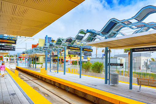
Connecting communities between Artesia and Downtown LA with new light rail to expand access to opportunities.

Project Type
Mixed-Mode
Current Phase
Design
Estimated Project Completion
2035
A new light rail line will connect the A Line at Slauson Station to Artesia, bringing 14.5-miles of Metro Rail service to the heart of Southeast LA County for the first time. This project will serve 11 communities, including Cerritos, Bellflower, South Gate and Vernon—home to over 1.4 million residents and more than 600,000 jobs.
 
The project will feature:
    • Nine new light rail stations
    • One new C Line infill station at I-105
    • Up to five parking facilities
    • A maintenance and storage facility in Bellflower
    • 30 at-grade and 15 elevated crossings
In 2024, the project received CEQA certification and a Record of Decision, enabling Metro to seek federal funding. Metro also secured $231 million through California’s TIRCP program. A separate study is currently looking at extending the line north from Slauson to Union Station.

Status Update

Metro will conduct underground utility investigations in the City of South Gate to support future engineering design. Work includes excavation activities to identify existing underground utilities at multiple locations along the alignment. Activities will occur on weekdays between late March and late May, with varying work hours by location. Temporary traffic impacts are expected, including lane reductions, localized closures, and construction equipment in the roadway. Access to residences, businesses, and emergency services will be maintained. Work areas will be restored following completion of drilling activities, including pavement repair where needed. | Full Notice

Design & Technical Development

Understand the Big Picture

Learn the project’s goals to improve mobility and sustainable growth across southeast Los Angeles County.

Check Local Work Notices

Review current construction notices, including locations, dates, work hours, traffic impacts and closure updates.

Online Purchase

Stay Informed

Sign up to receive construction notices and project updates.

Events

No Events Found

Documents

Folder
Name
Type
Name of the document if it’s long
Description of folder if the description is too long then it will
1.25GB
Download

Frequently Asked Questions

What communities will the line serve?
The new light rail line will serve a dense and diverse area of Southeast Los Angeles County. Communities along the proposed route include Artesia, Cerritos, Bellflower, Paramount, Downey, South Gate, Cudahy, Bell, Huntington Park, Vernon and the unincorporated community of Florence-Firestone.
 
Metro is also looking at an extension that would connect the line to Union Station in Downtown Los Angeles.
How many stations will there be?
The approved segment from Slauson Station on the A Line to the proposed Pioneer Station in Artesia will include nine new light rail stations, along with an infill station at the I-105 Freeway on the existing C Line.
 
Proposed station areas (subject to change in future design phases) include:
 
– Slauson/A Line
– Bellflower Bl
– Paramount/Rosecrans
– Downey/Somerset
– Pioneer Station (Artesia)
What does EIR and EIS stand for?
An Environmental Impact Report (EIR) is required under the California Environmental Quality Act (CEQA), while an Environmental Impact Statement (EIS) is required under the National Environmental Policy Act (NEPA).
 
Together, these documents:
Outline potential environmental impacts
– Identify mitigation strategies
– Invite public and agency input
– Recommend a Locally Preferred Alternative (LPA)
 
This process helps ensure that major infrastructure projects are carried out with transparency and community participation.
What are civil improvements?
Civil improvements are street and road features that help integrate light rail into the surrounding environment—ensuring safe operations, convenient access for riders and community compatibility.
 
These include:
– Trackway and signal installation
– Roadway widening
– Temporary and permanent bus stop relocations
– Curb, gutter and sidewalk replacement
– Adjustments to benches, streetlights, meters and signage
– Final paving and restoration
What is the current state of the project?

The environmental review process has been completed. In April 2024, the Metro Board certified the EIR/EIS. In August 2024, the Federal Transit Administration issued a Record of Decision, making the project eligible for federal funding. Additionally, Metro secured $231 million in early-stage state funding through the Transit and Intercity Rail Capital Program (TIRCP) in October 2024. The project is now advancing into the design phase.

Get Involved

Help shape this project for good. We want to hear from you:

Got questions or ideas? Our project team is here to listen.

Got questions or ideas? Our project team is here to listen.

Our team is here to support your questions and help you understand what this work means for your community. We can help explain design options, features, and how community feedback shapes each stage of the work.

Channels are monitored to make sure you receive timely support.

Receive our project emails!

Receive our project emails!

Register to receive detailed updates and essential information about our projects directly to your inbox. Stay informed and engaged as we progress, ensuring you have all the latest developments and key insights at your fingertips.

 
Scroll to Top