Metro Maps and Schedules
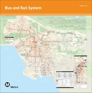
Metro Maps
The maps below feature bus and rail service for the new D Line Extension Section 1 stations, which opened to the public on Friday, May 8.
Regional System Maps provide a closer look at transit service in the five sectors within Metro’s service areas:
Note: Printed Regional Maps will be made available at Customer Centers and other locations at the beginning of July 2026.


Bus Schedules
| Line | Description | |
|---|---|---|
| Line 2 | Westwood - Exposition Park via Sunset Bl | Download PDF |
| Line 4 | Santa Monica - Downtown LA via Santa Monica Bl | Download PDF |
| Line 10 | West Hollywood - Downtown LA via Temple St, Melrose Av | Download PDF |
| Line 14 | Cedars Sinai Medical Center - Downtown LA via Beverly Bl | Download PDF |
| Line 16 | West Hollywood - Downtown LA via West 3rd St | Download PDF |
| Line 18 | Wilshire/Western Station - Montebello Metrolink Station via 6th St, Whittier Bl | Download PDF |
| Line 20 | Santa Monica - Downtown LA via Wilshire Bl | Download PDF |
| Line 28 | Century City - Downtown LA via Olympic Bl | Download PDF |
| Line 30 | Pico Rimpau Transit Center - Little Tokyo Station via Pico Bl | Download PDF |
| Line 33 | Santa Monica - Downtown LA via Venice Bl | Download PDF |
| Line 35 | Downtown LA - Washington/Fairfax via Washington Bl | Download PDF |
| Line 37 | Downtown LA - Washington/Fairfax via Adams Bl | Download PDF |
| Line 38 | Downtown LA - Washington/Fairfax via Jefferson Bl | Download PDF |
| Line 40 | South Bay/Redondo Beach - Downtown LA via King Bl, Hawthorne Bl | Download PDF |
| Line 45 | Harbor Freeway Station - Lincoln Heights via Broadway | Download PDF |
| Line 48 | Downtown LA - Avalon Station via Main St, South San Pedro St | Download PDF |
| Line 51 | CSU Dominguez Hills - Westlake/MacArthur Park Station via San Pedro St, Avalon Bl | Download PDF |
| Line 53 | CSU Dominguez Hills - Downtown LA via Central Av | Download PDF |
| Line 55 | Willowbrook/Rosa Parks Station - Downtown LA via Compton Av | Download PDF |
| Line 60 | Artesia Station - Downtown LA via Long Beach Bl | Download PDF |
| Line 62 | Hawaiian Gardens - Downtown LA via Telegraph Rd | Download PDF |
| Line 66 | Wilshire Center - Montebello Metrolink Station via 8th St, Olympic Bl | Download PDF |
| Line 70 | Downtown LA - El Monte via Cesar Chavez Av, Garvey Av | Download PDF |
| Line 74 | Monterey Park-Montebello via Garvey Av, 1st St | Download PDF |
| Line 76 | Downtown LA - El Monte via Valley Bl | Download PDF |
| Line 78 | Downtown LA - Arcadia via Las Tunas Av, Huntington Dr | Download PDF |
| Line 81 | Eagle Rock - Harbor Freeway Station via Figueroa St | Download PDF |
| Line 90 | Downtown LA - North Hollywood Station via Glendale Av, Foothill Bl, Vineland Av | Download PDF |
| Line 92 | Downtown LA - Sylmar Station via Glendale Bl, Glenoaks Bl | Download PDF |
| Line 93 | Glendale Galleria - Grand/LATTC Station via San Fernando Rd, Rampart Bl, Hoover St | Download PDF |
| Line 94 | Downtown LA - North Hollywood via San Fernando Rd, Magnolia Bl | Download PDF |
| Line 102 | LAX/Metro Transit Center - South Gate via La Tijera Bl, Exposition Bl | Download PDF |
| Line 105 | Vernon - West Hollywood via La Cienega Bl, Vernon Av | Download PDF |
| Line 106 | Monterey Park - Montebello via Garvey Av, 1st Av | Download PDF |
| Line 108 | Marina Del Rey - Pico Rivera via Slauson Av | Download PDF |
| Line 110 | Playa Vista - Bell Gardens via Jefferson Bl, Gage Av | Download PDF |
| Line 111 | LAX/Metro Transit Center - Norwalk Station via Florence Av | Download PDF |
| Line 115 | Playa Del Rey - Norwalk via Manchester Av, Firestone Bl | Download PDF |
| Line 117 | LAX/Metro Transit Center - Downey via Century Bl, Imperial Hwy | Download PDF |
| Line 120 | LAX/Metro Transit Center - Whittwood Center via Imperial Hwy | Download PDF |
| Line 125 | El Segundo - Norwalk Station via Rosecrans Av | Download PDF |
| Line 127 | Harbor Freeway Station - Downey via Compton Bl, Broadway | Download PDF |
| Line 128 | Compton Station - Cerritos Towne Center via Alondra Bl | Download PDF |
| Line 134 | Downtown Santa Monica Station - Malibu via Pacific Coast Hwy | Download PDF |
| Line 150 | Chatsworth - Encino via Topanga Canyon Bl, Ventura Bl | Download PDF |
| Line 152 | West Hills - North Hollywood via Roscoe Bl, Lankershim Bl | Download PDF |
| Line 154 | Van Nuys - Burbank Station via Oxnard St, Burbank Bl | Download PDF |
| Line 155 | Burbank Station - North Hollywood Station via Riverside Dr, Olive St | Download PDF |
| Line 158 | Chatsworth Station - Sherman Oaks via Devonshire St, Woodman Av | Download PDF |
| Line 161 | Thousand Oaks - Canoga Station via Westlake Village, Agoura Hillls, Calabasas | Download PDF |
| Line 162 | Woodland Hills - North Hollywood via Fallbrook Av, Sherman Wy, Vineland Av | Download PDF |
| Line 164 | West Hills - Burbank via Victory Bl | Download PDF |
| Line 165 | West Hills - Burbank via Vanowen St | Download PDF |
| Line 166 | Chatsworth - Sun Valley via Nordhoff St, Osborne St | Download PDF |
| Line 167 | Chatsworth Station - Studio City via Plummer St, Coldwater Canyon Av | Download PDF |
| Line 169 | Canoga Station - Burbank via Saticoy St, Valley Circle Bl | Download PDF |
| Line 179 | Rose Hill - Arcadia via Huntington Dr | Download PDF |
| Line 180 | Hollywood - Pasadena via Los Feliz Bl, Colorado Bl | Download PDF |
| Line 182 | East Hollywood - Rose Hill via Fletcher Dr, York Bl | Download PDF |
| Line 202 | Rancho Dominguez - Willowbrook via Willowbrook Av | Download PDF |
| Line 204 | Athens - Hollywood via Vermont Av | Download PDF |
| Line 205 | San Pedro - Willowbrook/Rosa Parks Station via Wilminton Av, Vermont Av, Western Av | Download PDF |
| Line 206 | Athens - Hollywood via Normandie Av | Download PDF |
| Line 207 | Athens - Hollywood via Western Av | Download PDF |
| Line 209 | Gardena - Expo/Crenshaw Station via Van Ness Av, Arlington Av | Download PDF |
| Line 210 | South Bay/Redondo Beach Transit Center - Hollywood/Vine Station via Crenshaw Bl | Download PDF |
| Line 211/215 | Redondo Beach - Inglewood via Prairie Av, Inglewood Av | Download PDF |
| Line 212 | Hawthorne/Lennox Station - Hollywood/Highland Station via La Brea Av | Download PDF |
| Line 217 | La Cienega/Jefferson Station - Eagle Rock Plaza via Broadway, Los Feliz Bl, Hollywood Bl, Fairfax Av | Download PDF |
| Line 218 | Beverly Hills - Studio City via Laurel Canyon Bl | Download PDF |
| Line 222 | Hollywood - Sun Valley via Hollywood Wy, Cahuenga Bl | Download PDF |
| Line 224 | Hollywood - Sylmar via San Fernando Rd, Lankershim Bl | Download PDF |
| Line 230 | Studio City - Sylmar Station via Laurel Canyon Bl | Download PDF |
| Line 232 | Downtown Long Beach - LAC/Metro Transit Center via Sepulveda Bl, Pacific Coast Hwy | Download PDF |
| Line 233 | West LA - Lakeview Terrace via Van Nuys Bl, Sepulveda Bl | Download PDF |
| Line 234 | Sherman Oaks - Sylmar via Sepulveda Bl | Download PDF |
| Line 235/236 | Encino - Sylmar via Balboa Bl, Rinaldi St, Foothill Bl, Glenoaks Bl | Download PDF |
| Line 237 | Encino - North Hollywood via White Oak Av, Rinaldi St, Woodley Av | Download PDF |
| Line 240 | Northridge - Universal City via Reseda Bl, Ventura Bl | Download PDF |
| Line 242/243 | Woodland Hills, Tarzana - Northridge, Chatsworth via Tampa Av, Winnetka Av | Download PDF |
| Line 244 | Woodland Hills - Chatsworth via De Soto Av | Download PDF |
| Line 246 | San Pedro - Harbor Gateway Transit Center via Avalon Bl | Download PDF |
| Line 251 | Lynwood - Eagle Rock via Soto St, Eagle Rock Bl | Download PDF |
| Line 258 | Paramount - Highland Park via Fremot Av, Eastern Av, York Bl | Download PDF |
| Line 260/261 | Willowbrook/Rosa Parks Station, Artesia Station - Pasadena via Fair Oaks Bl, Atlantic Bl | Download PDF |
| Line 265 | Lakewood Center Mall - Pico Rivera via Paramount Bl | Download PDF |
| Line 266 | Lakewood Center Mall - Sierra Madre Villa Station via Rosemead Bl, Lakewood Bl | Download PDF |
| Line 267 | El Monte Station - Altadena via Temple City Bl, Del Mar Bl, Colorado Bl, Allen Av | Download PDF |
| Line 268 | El Monte Station - Sierra Madre Villa Station via Baldwin Av, Sierra Madre Bl | Download PDF |
| Line 287 | The Shops at Montebello - Arcadia Station via Santa Anita Av, Paramount Bl | Download PDF |
| Line 294 | Burbank Station - Sylmar Station via San Fernando Rd | Download PDF |
| Line 296 | Lincoln/Cypress Station - Burbank Station via Riverside Dr | Download PDF |
| Line 344 | Palos Verdes - Harbor Gateway Transit Center via Hawthorne Bl | Download PDF |
| Line 460 | Downtown LA - Disneyland | Download PDF |
| Line 487/489 | Downtown LA - Sierra Madre Villa Station | Download PDF |
| Line 501 | North Hollywood Station - Pasadena via 134 Fwy | Download PDF |
| Line 550 | Harbor Gateway Transit Center - Exposition Park via Harbor Transitway | Download PDF |
| Line 577 | Long Beach VA Medical Center - El Monte Station via 605 Fwy | Download PDF |
| Line 601 | Warner Center Shuttle | Download PDF |
| Line 602 | Pacific Palisades - Westwood via Sunset Bl | Download PDF |
| Line 605 | LAC + USC Medical Center Shuttle | Download PDF |
| Line 611 | Huntington Park Shuttle | Download PDF |
| Line 617 | Pico/Robertson - Culver City via Beverly Dr, Burton Wy, Robertson Bl | Download PDF |
| Line 660 | Pasadena - Altadena via Fair Oaks Av | Download PDF |
| Line 662 | Pasadena - Altadena Shuttle | Download PDF |
| Line 665 | Rose Hill Transit Center - Indian & Olympic via Indiana St, Gage Ave, Eastern | Download PDF |
| Line 690 | Sylmar - Sunland via Foothil Bl, Roxford St, San Fernando Rd | Download PDF |
| Line 720 | Santa Monica - Downtown LA via Wilshire Bl | Download PDF |
| Line 754 | Athens - Hollywood via Vermont Av | Download PDF |
| Line 761 | West Los Angeles - Sylmar via San Fernando Bl, Van Nuys Bl, Sepulveda Bl | Download PDF |